


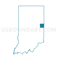
SPARTANBURG, Randolph County, Indiana
About
Outline

Summary
| Unique Area Identifier | 580268 |
| Name | SPARTANBURG |
| County | Randolph County |
| State | Indiana |
| Area (square miles) | 46.09 |
| Land Area (square miles) | 46.04 |
| Water Area (square miles) | 0.05 |
| % of Land Area | 99.90 |
| % of Water Area | 0.10 |
| Latitude of the Internal Point | 40.05793420 |
| Longtitude of the Internal Point | -84.86653590 |
Maps


Graphs
Select a template below for downloading or customizing gragh for SPARTANBURG, Randolph County, Indiana


Neighbors
Neighoring Voting District (by Name) Neighboring Voting District on the Map
- FRANKLIN 01, Wayne County, IN
- NEW GARDEN 01, Wayne County, IN
- PRECINCT HARRISON WEST & HOLLANSBURG, Darke County, OH
- PRECINCT LIBERTY TWP & PALESTINE, Darke County, OH
- PRECINCT WASHINGTON TOWNSHIP, Darke County, OH
- WASHINGTON, Randolph County, IN
- WAYNE, Randolph County, IN
- WHITE RIVER 2, Randolph County, IN
Top 10 Neighboring County Subdivision (by Population) Neighboring County Subdivision on the Map
- White River township, Randolph County, IN (7,513)
- Wayne township, Randolph County, IN (4,611)
- Harrison township, Darke County, OH (2,255)
- Washington township, Randolph County, IN (2,172)
- New Garden township, Wayne County, IN (1,977)
- Franklin township, Wayne County, IN (1,370)
- Washington township, Darke County, OH (1,325)
- Greensfork township, Randolph County, IN (1,082)
- Liberty township, Darke County, OH (1,071)
Top 10 Neighboring Unified School District (by Population) Neighboring Unified School District on the Map
- Greenville City School District, OH (22,536)
- Randolph Central School Corporation, IN (9,887)
- Northeastern Wayne Schools, IN (5,841)
- Randolph Eastern School Corporation, IN (5,230)
- Tri-Village Local School District, OH (4,375)
- Mississinawa Valley Local School District, OH (4,148)
- Randolph Southern School Corporation, IN (3,254)
Top 10 Neighboring State Legislative District Lower Chamber (by Population) Neighboring State Legislative District Lower Chamber on the Map
- State House District 77, OH (118,691)
- State House District 54, IN (63,197)
- State House District 33, IN (58,513)
Top 10 Neighboring State Legislative District Upper Chamber (by Population) Neighboring State Legislative District Upper Chamber on the Map
Top 10 Neighboring 111th Congressional District (by Population) Neighboring 111th Congressional District on the Map
Top 10 Neighboring Census Tract (by Population) Neighboring Census Tract on the Map
- Census Tract 5601, Darke County, OH (7,191)
- Census Tract 5101, Darke County, OH (4,201)
- Census Tract 102, Wayne County, IN (3,353)
- Census Tract 9520, Randolph County, IN (3,308)
Top 10 Neighboring 5-Digit ZIP Code Tabulation Area (by Population) Neighboring 5-Digit ZIP Code Tabulation Area on the Map
- 45331, OH (22,930)
- 47394, IN (8,470)
- 47390, IN (5,310)
- 45390, OH (3,461)
- 47355, IN (2,885)
- 47341, IN (2,283)
- 45332, OH (612)